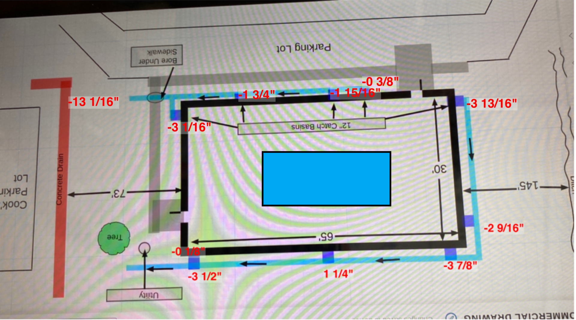
SMART LEVEL IMAGE MAPPING
Just take a photo and Smart Level does the rest!
A GAME CHANGING INNOVATION
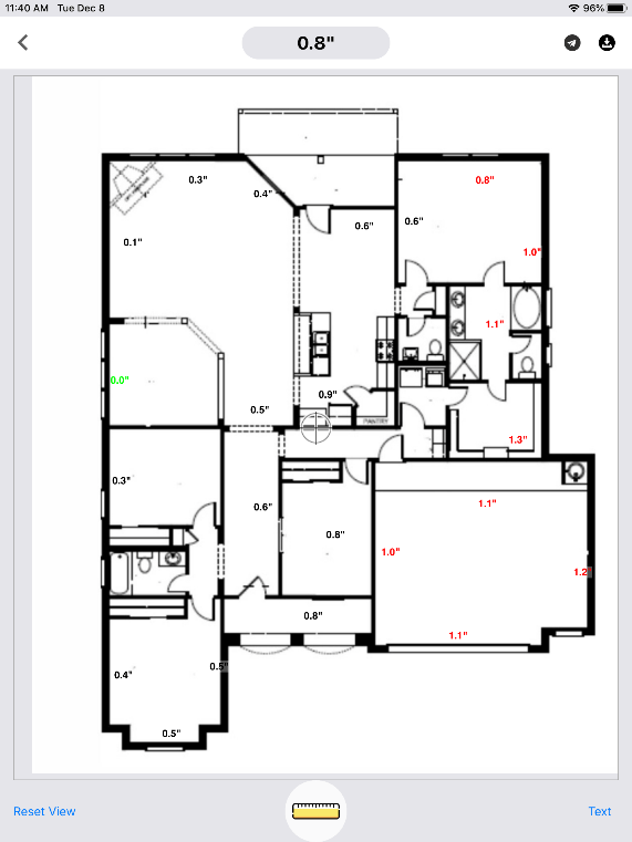
Simply load a photo from your phone into the app and then Smart Level will plot height and distance measurements directly into the image. This can be a photo you took on the job site with your phone, a drone image, a google map image, a pdf of a floor plan. Just about anything you need to measure and document.
- Load the image
- Set the Smart Level display where you want to measure.
- Align the crosshairs in the image with where you have set the display.
- Click add reading in the app. Its as easy as that!
SEE THE SMART LEVEL IMAGE MAPPING IN ACTION
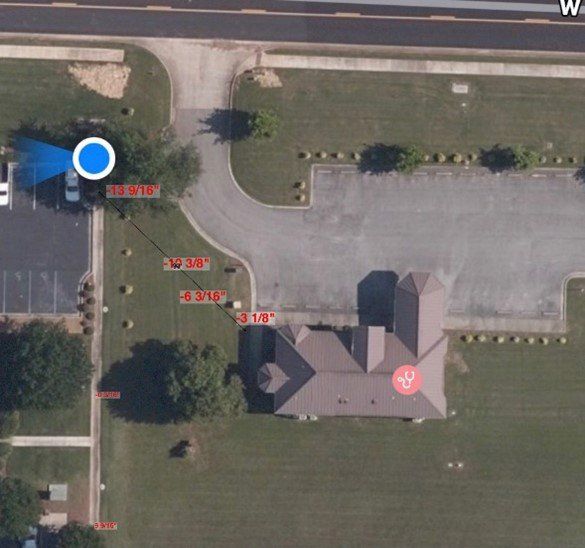
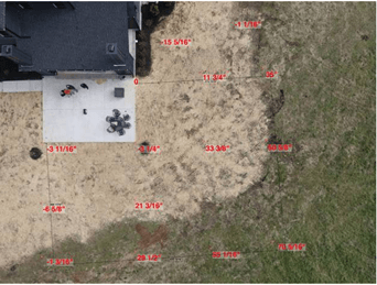
Google Map Uploaded and Measured
Plan of Building From the Google Map to the Left
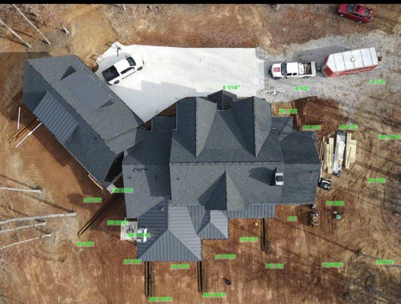
SMART LEVEL DRONE PHOTOS
Click the Image Below to Enlarge